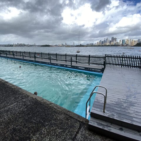
Embark on an unforgettable adventure with our ultimate guide to the best day hikes in Sydney. From the awe-inspiring Blue Mountains to the breathtaking coastal trails of the Royal National Park, Sydney’s diverse landscapes offer a myriad of hiking experiences for all skill levels. Whether you’re seeking a leisurely stroll along the picturesque coastline or a challenging trek through rugged wilderness, our carefully curated list of hikes will take you on a journey through some of the most stunning natural wonders in and around Sydney. So, lace up your hiking boots, pack your camera, and get ready to explore the extraordinary beauty of these must-visit day hikes in Sydney.
Best Day Hikes Sydney at a Glance
Our list of best day hikes in Sydney goes like this:
- The best hike in Sydney for panoramic views: McMahon’s Lookout Wentworth Falls
- The best canyon hike in Sydney: Grand Canyon Track (Blue Mountains)
- The most challenging hike in Sydney: Great North Walk-Watagans National Park
- The best coastal hike in Sydney: Bouddi Coastal Walk
- The most unique hike in Sydney: Wollemi National Park (Glow Worm Tunnel)
- The best hike in Sydney for waterfall views: Wattamolla Beach to Curracurrong Falls
- The most rewarding hike in Sydney: Wentworth Pass
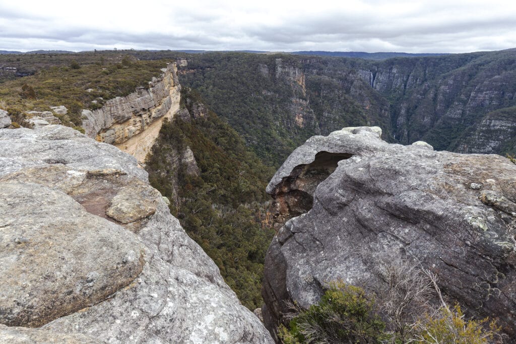
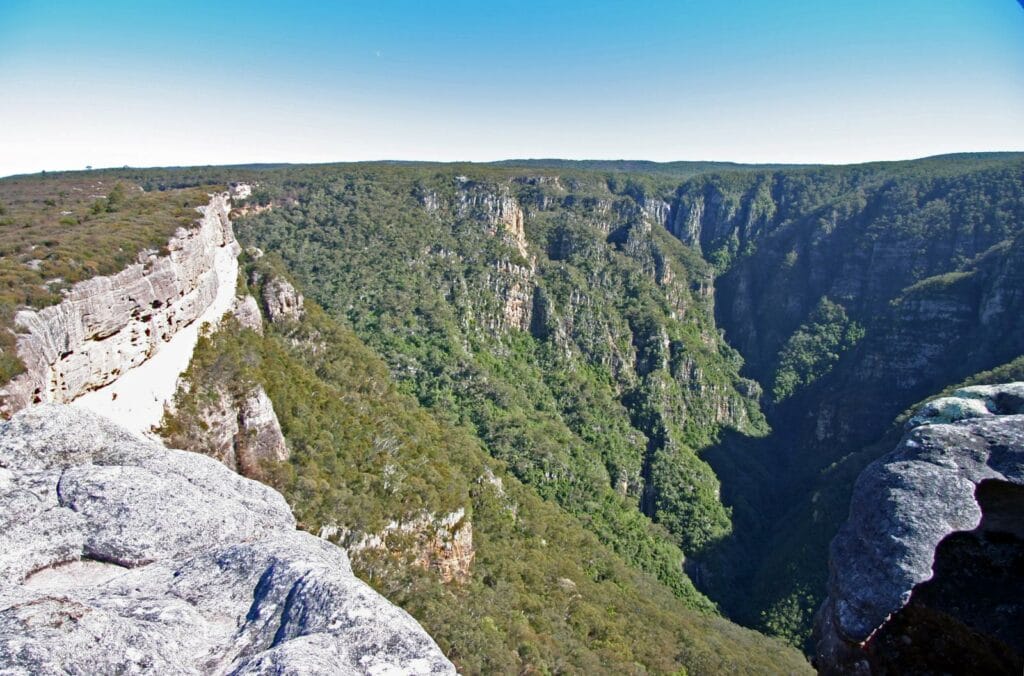
1. Grand Canyon Track (Blue Mountains)
The Blue Mountains Grand Canyon Loop is a must-do for any hiking enthusiast. This trail takes you through a stunning canyon, with lush vegetation, cascading waterfalls, and breathtaking views of the Grose Valley. The trail is well-marked and offers a unique perspective of the Blue Mountains’ rugged beauty.

The hike starts at the Evans Lookout car park and descends into the canyon, following a creek before climbing back up to the cliff tops. The trail is a loop, so you’ll end up back at the starting point. Along the way, you’ll pass through a variety of landscapes, including fern-filled gullies, sandstone cliffs, and eucalyptus forests.
This hike is a great way to escape the city and immerse yourself in nature. The trail is relatively challenging, with some steep sections and stairs, but the stunning views and unique landscapes make it well worth the effort.
- Difficulty Rating: Moderate to Hard
- Start Location: Evans Lookout car park
- End Location: Evans Lookout car park
- Route Distance: 6.3 km
- Time to Complete: 3-4 hours
- Facilities: Toilets and picnic facilities at the start/end point, no parking fees
- Distance and travel time from CBD: Approximately 120 km, 2 hours by car
- Google Map Link: https://maps.app.goo.gl/tyQjcsPHEj9zNDwFA
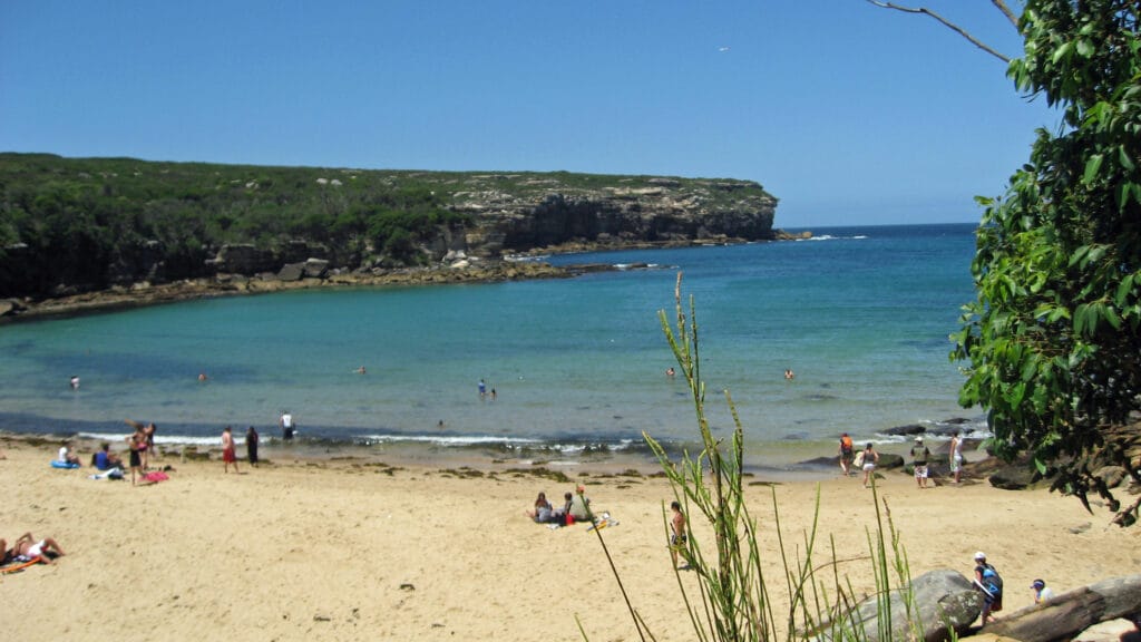
2. Royal National Park (Coast Track)
The Coast Track in the Royal National Park is one of Sydney’s most iconic hikes. This trail offers stunning coastal views, beautiful beaches, and a variety of landscapes, including heathland, rainforest, and cliffs.
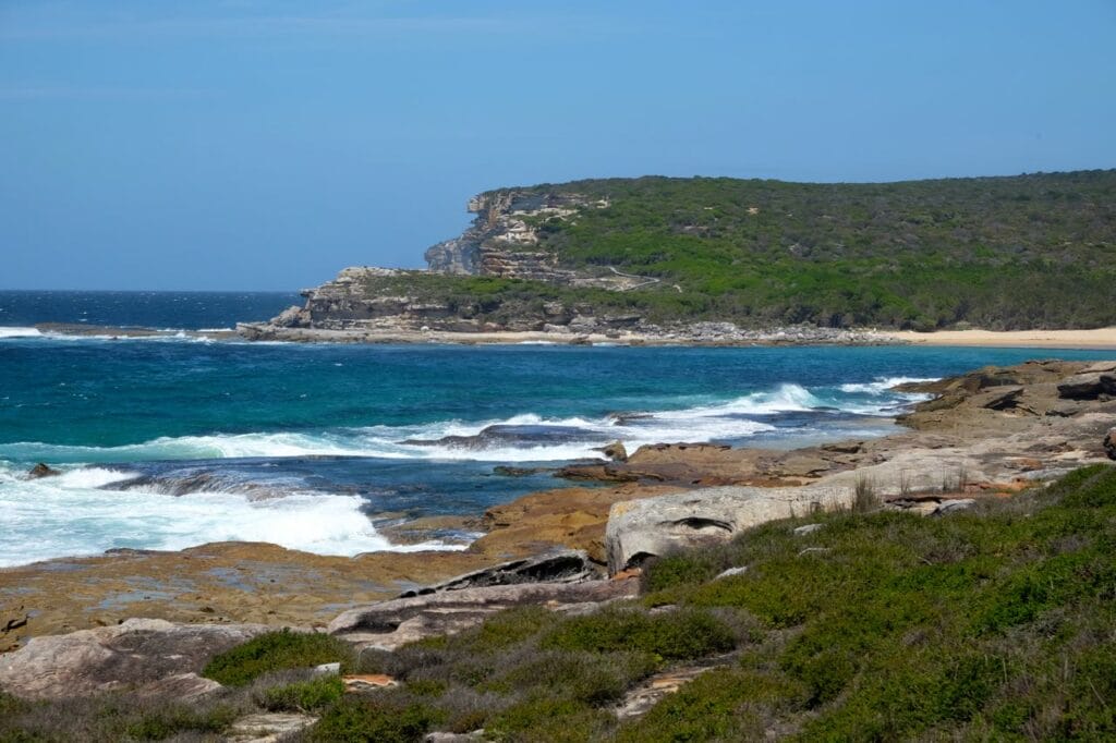
The hike starts at Bundeena and follows the coastline south to Otford. Along the way, you’ll pass through a variety of landscapes, including heathland, rainforest, and cliffs. The trail offers stunning views of the coastline and the Pacific Ocean, and there are plenty of opportunities to stop and enjoy the scenery.
This hike is a great way to explore the Royal National Park and enjoy the stunning coastal scenery. The trail is well-marked and offers a variety of landscapes, making it a great choice for a day hike.
- Difficulty Rating: Moderate to Hard
- Start Location: Bundeena
- End Location: Otford
- Route Distance: 26 km
- Time to Complete: 10-12 hours
- Facilities: Toilets and picnic facilities at various points along the trail, parking available at Bundeena
- Distance and travel time from CBD: Approximately 30 km, 1 hour by car to Bundeena
- Google Map Link: https://maps.app.goo.gl/qgjTW6P8FeFEfujU6
3. Warrumbungle National Park (Breadknife and Grand High Tops walk)
The Breadknife and Grand High Tops walk in Warrumbungle National Park is a challenging but rewarding hike. This trail takes you through rugged landscapes, with stunning views of the park’s iconic rock formations.
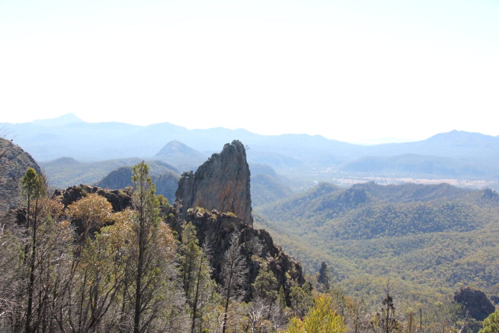
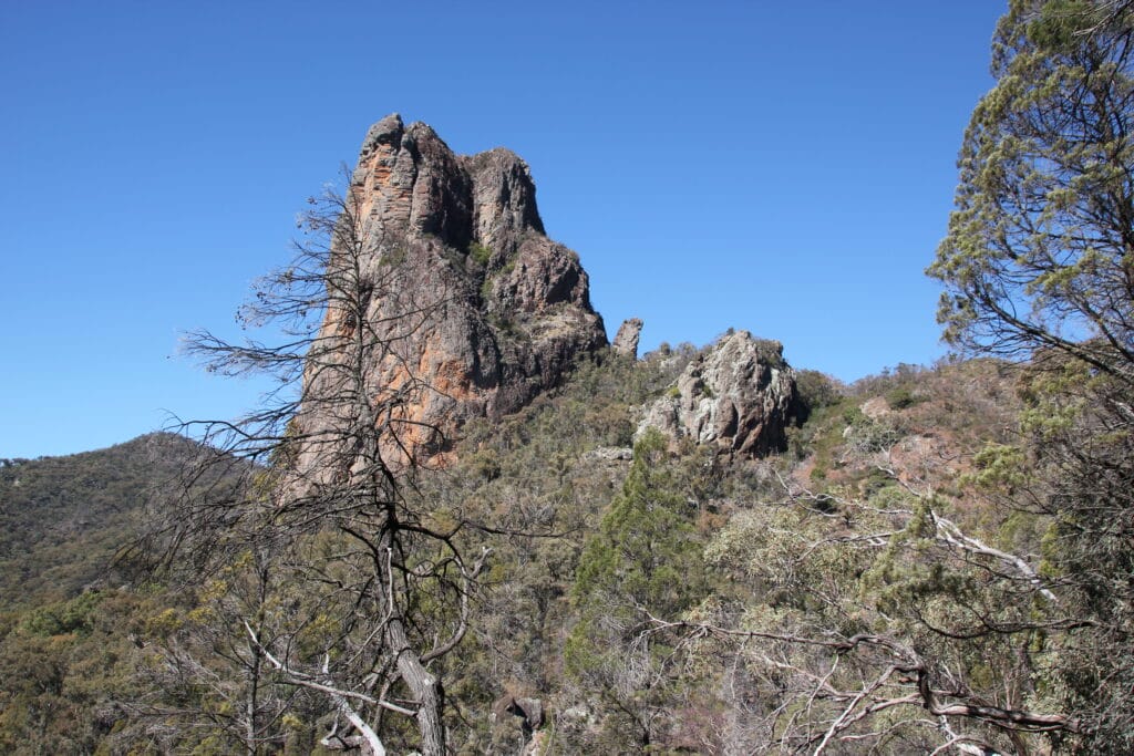
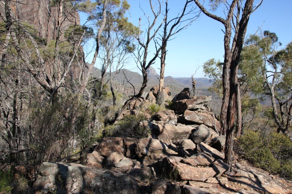
The hike starts at Pincham car park and follows a well-marked trail to the Grand High Tops, a stunning viewpoint that offers panoramic views of the park. Along the way, you’ll pass the Breadknife, a striking rock formation that is one of the park’s most famous landmarks.
This hike is a great way to explore Warrumbungle National Park and enjoy the stunning natural beauty of the area. The trail is challenging, with some steep sections and stairs, but the stunning views and unique landscapes make it well worth the effort.
- Difficulty Rating: Hard
- Start Location: Pincham car park
- End Location: Pincham car park
- Route Distance: 14.5 km
- Time to Complete: 5-6 hours
- Facilities: Toilets and picnic facilities at the start/end point, parking available at Pincham car park
- Distance and travel time from CBD: Approximately 550 km, 6 hours by car
- Google Map Link: https://maps.app.goo.gl/kNJJW7R953LFL5FZ8
4. Kanangra-Boyd National Park (Kanangra Walls)
The Kanangra Walls hike in Kanangra-Boyd National Park is a relatively easy but incredibly rewarding walk. The trail takes you to the edge of the Kanangra Walls, a stunning cliff face that offers panoramic views of the surrounding wilderness.
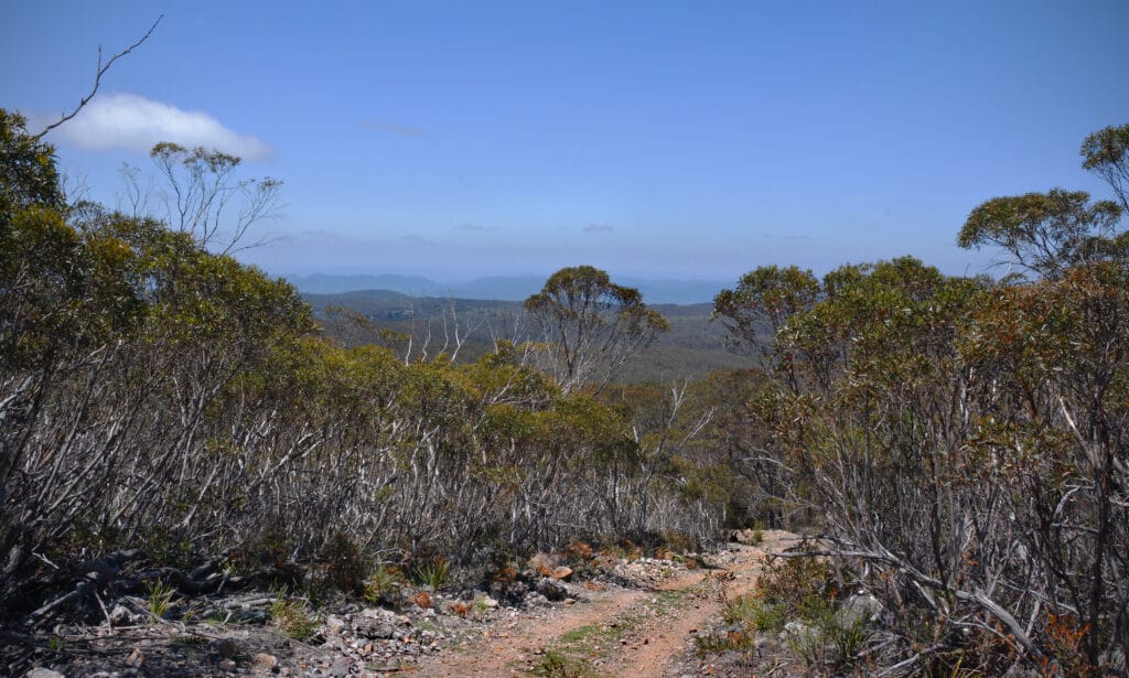
The hike starts at the Kanangra Walls car park and follows a well-marked trail to the lookout. Along the way, you’ll pass through a variety of landscapes, including eucalyptus forests and heathland. The trail offers stunning views of the Kanangra Walls and the surrounding wilderness, making it a great choice for a day hike.
- Difficulty Rating: Easy to Moderate
- Start Location: Kanangra Walls car park
- End Location: Kanangra Walls car park
- Route Distance: 2 km
- Time to Complete: 1-2 hours
- Facilities: Toilets and picnic facilities at the start/end point, parking available at Kanangra Walls car park
- Distance and travel time from CBD: Approximately 180 km, 3 hours by car
- Google Map Link: https://maps.app.goo.gl/TyBG3dnxxTukF5Vf8
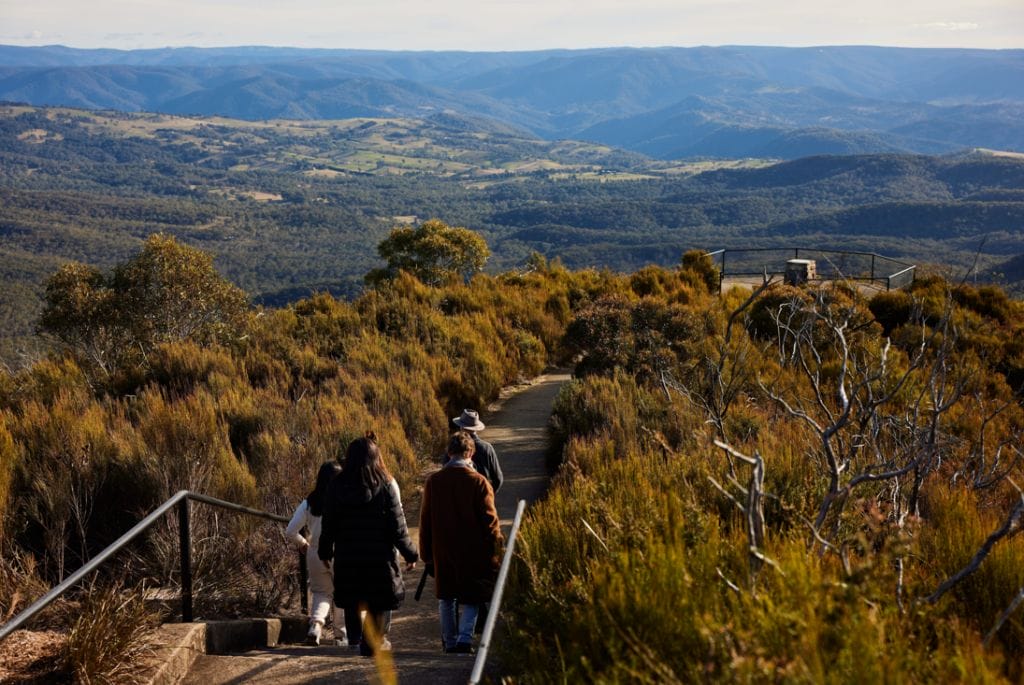
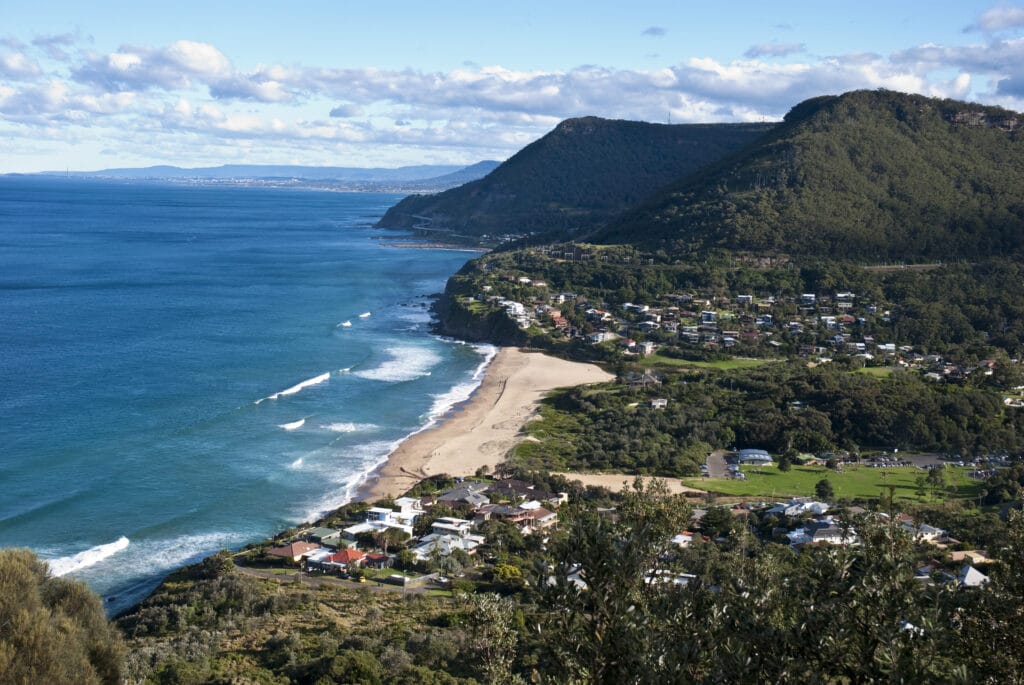
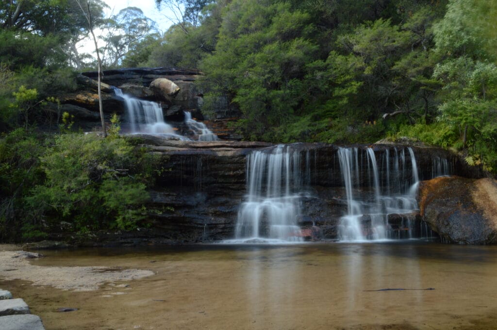
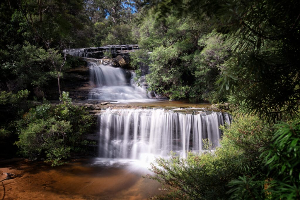
5. McMahon’s Lookout Wentworth Falls
McMahon’s Lookout Wentworth Falls is a hidden gem in the Blue Mountains. This relatively easy hike takes you to a stunning lookout point that offers panoramic views of the Jamison Valley and the Kings Tableland.
The hike starts at the McMahon’s Lookout car park and follows a well-marked trail to the lookout. The trail is relatively flat and easy to follow, making it a great choice for beginners or those looking for a leisurely walk. The lookout offers stunning views of the surrounding landscape, making it a great spot for a picnic or a photo opportunity.
This hike is a great way to enjoy the natural beauty of the Blue Mountains without the crowds. The trail is relatively easy, making it a great choice for a leisurely day hike.
- Difficulty Rating: Easy
- Start Location: McMahon’s Lookout car park
- End Location: McMahon’s Lookout car park
- Route Distance: 1.6 km
- Time to Complete: 1-2 hours
- Facilities: No facilities at the start/end point, parking available at McMahon’s Lookout car park
- Distance and travel time from CBD: Approximately 95 km, 1.5 hours by car
- Google Map Link: https://maps.app.goo.gl/6MAfhtUCxe7gNYyk6
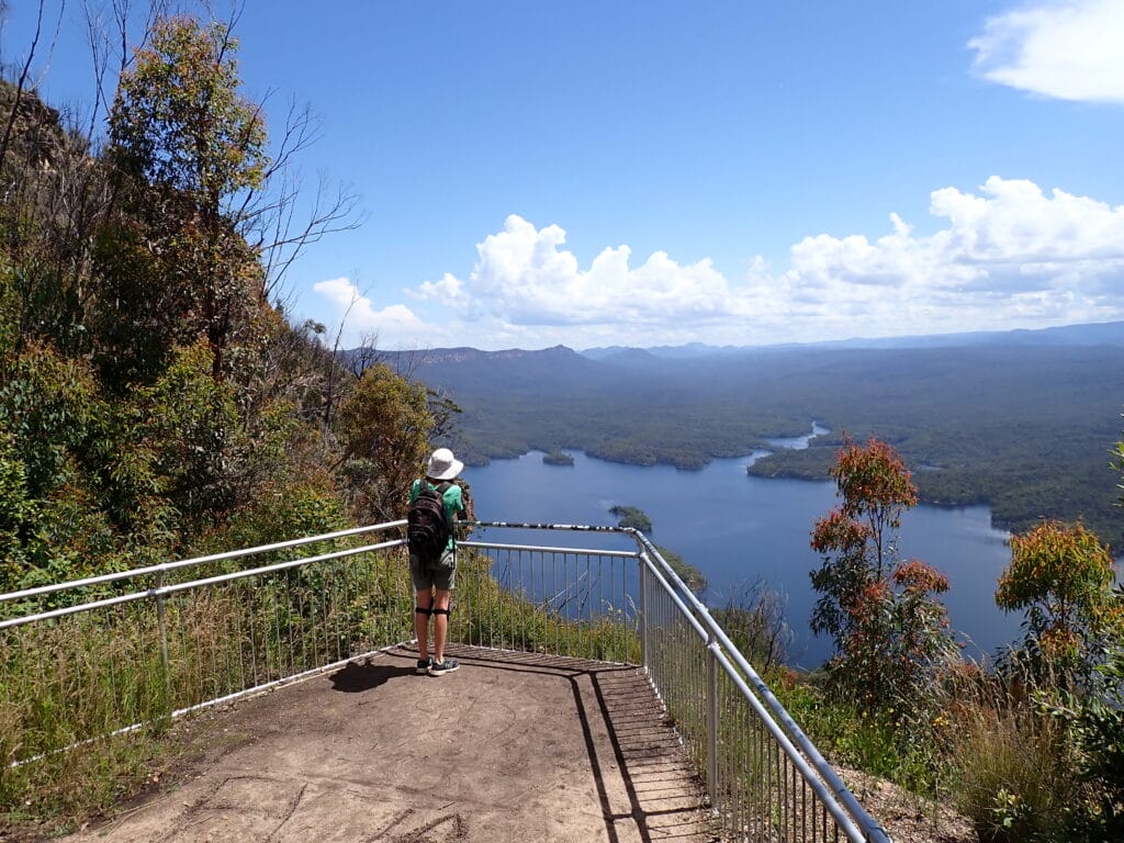
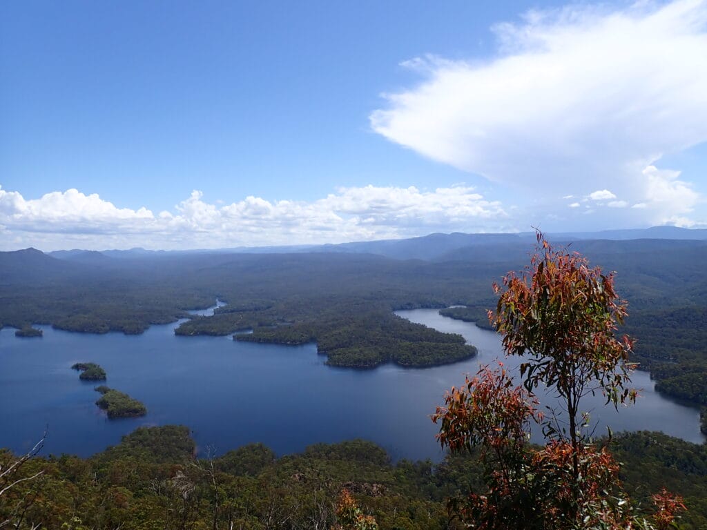
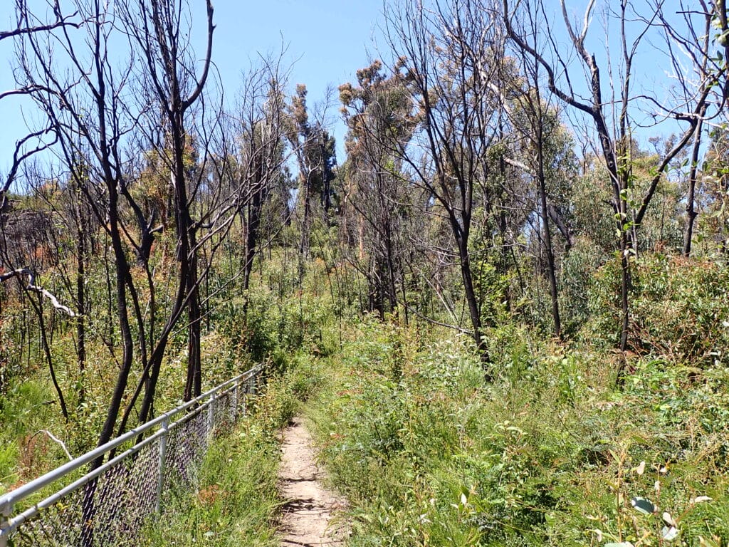
6. Great North Walk-Watagans National Park
The Great North Walk in Watagans National Park is a challenging but rewarding hike. This trail takes you through rugged landscapes, with stunning views of the park’s forests and mountains.
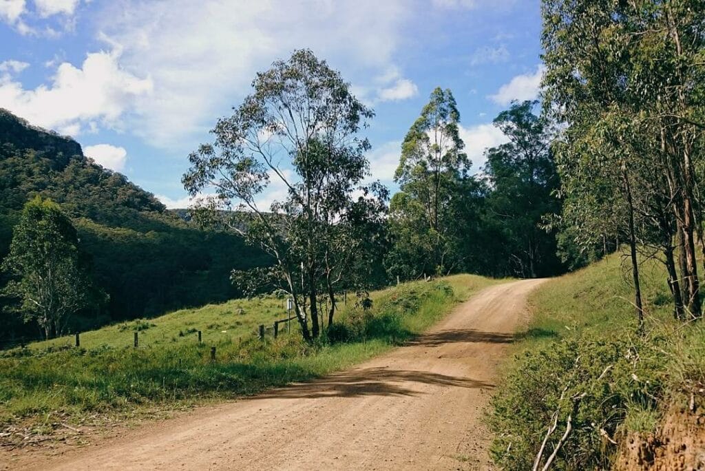
The hike starts at the Watagan Creek Road and follows a well-marked trail through the park. Along the way, you’ll pass through a variety of landscapes, including eucalyptus forests, rainforest, and cliffs. The trail offers stunning views of the surrounding landscape, making it a great choice for a day hike.
This hike is a great way to explore Watagans National Park and enjoy the stunning natural beauty of the area. The trail is challenging, with some steep sections and stairs, but the stunning views and unique landscapes make it well worth the effort.
- Difficulty Rating: Hard
- Start Location: Watagan Creek Road
- End Location: Watagan Creek Road
- Route Distance: 250 km
- Time to Complete: 14 days
- Facilities: Toilets and picnic facilities at various points along the trail, parking available at Watagan Creek Road
- Distance and travel time from CBD: Approximately 120 km, 2 hours by car
- Google Map Link: https://maps.app.goo.gl/shjCUBt8nGUMLKwf8
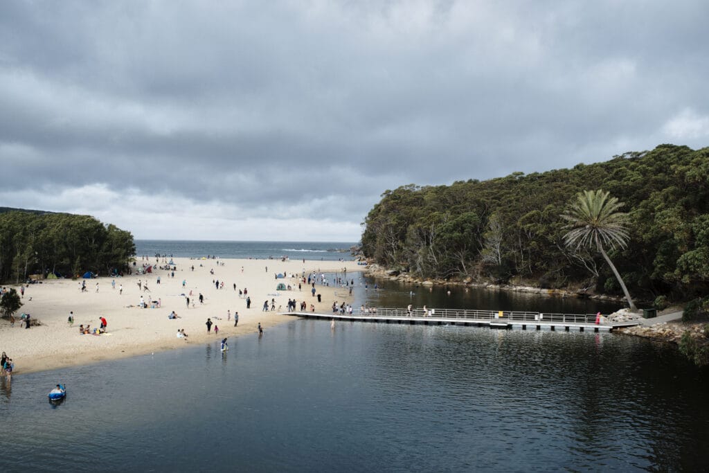
7. Bouddi Coastal Walk
The Bouddi Coastal Walk is a beautiful coastal walk that offers stunning views of the coastline and the Pacific Ocean. This trail takes you through a variety of landscapes, including beaches, cliffs, and heathland.
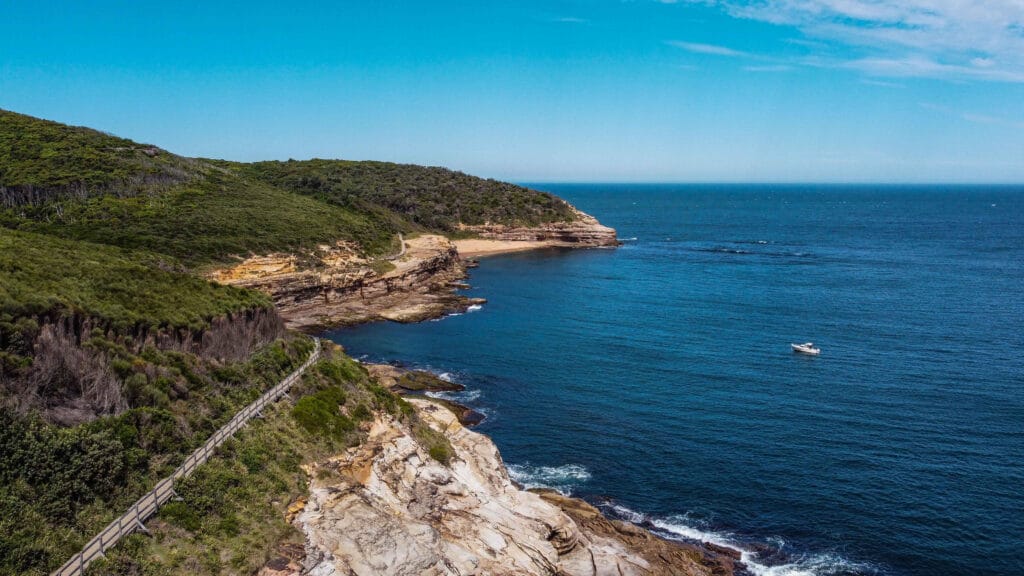
The hike starts at Putty Beach and follows the coastline to MacMasters Beach. Along the way, you’ll pass through a variety of landscapes, including beaches, cliffs, and heathland. The trail offers stunning views of the coastline and the Pacific Ocean, making it a great choice for a day hike.
This hike is a great way to explore the Bouddi National Park and enjoy the stunning coastal scenery. The trail is well-marked and offers a variety of landscapes, making it a great choice for a day hike.
- Difficulty Rating: Moderate
- Start Location: Putty Beach
- End Location: MacMasters Beach
- Route Distance: 8.5 km
- Time to Complete: 3-4 hours
- Facilities: Toilets and picnic facilities at various points along the trail, parking available at Putty Beach
- Distance and travel time from CBD: Approximately 90 km, 1.5 hours by car
- Google Map Link: https://maps.app.goo.gl/yRwdQnZXaTrR1FGB7
8. Wollemi National Park (Glow Worm Tunnel)
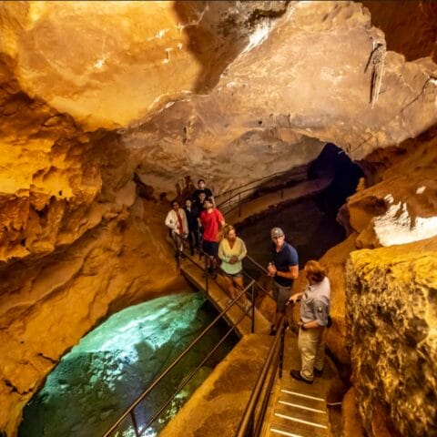
The Glow Worm Tunnel hike in Wollemi National Park is a unique and magical experience. This trail takes you through a disused railway tunnel that is now home to thousands of glow worms, creating a mesmerizing light show in the darkness.
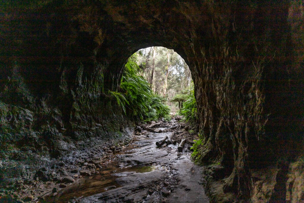


The hike starts at the Glow Worm Tunnel car park and follows a well-marked trail to the tunnel. The trail is relatively flat and easy to follow, making it a great choice for beginners or those looking for a leisurely walk. Once inside the tunnel, you’ll be treated to a stunning display of bioluminescence, as the glow worms light up the darkness.
This hike is a great way to experience the unique natural beauty of Wollemi National Park. The trail is relatively easy, making it a great choice for a leisurely day hike.
- Difficulty Rating: Easy
- Start Location: Glow Worm Tunnel car park
- End Location: Glow Worm Tunnel car park
- Route Distance: 2 km
- Time to Complete: 1-2 hours
- Facilities: No facilities at the start/end point, parking available at Glow Worm Tunnel car park
- Distance and travel time from CBD: Approximately 150 km, 3 hours by car
- Google Map Link: https://maps.app.goo.gl/S8iL6C19xzSuD2T97
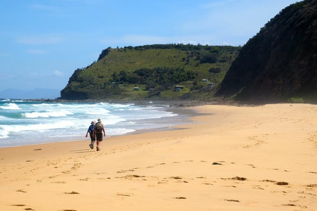
9. Wattamolla Beach to Curracurrong Falls
The Wattamolla Beach to Curracurrong Falls hike in the Royal National Park is a beautiful coastal walk that offers stunning views of the coastline and the Pacific Ocean. This trail takes you through a variety of landscapes, including beaches, cliffs, and heathland.
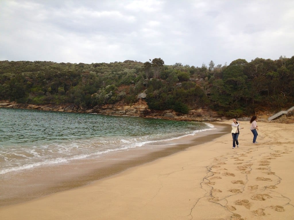
The hike starts at Wattamolla Beach and follows the coastline to Curracurrong Falls. Along the way, you’ll pass through a variety of landscapes, including beaches, cliffs, and heathland. The trail offers stunning views of the coastline and the Pacific Ocean, making it a great choice for a day hike.
This hike is a great way to explore the Royal National Park and enjoy the stunning coastal scenery. The trail is well-marked and offers a variety of landscapes, making it a great choice for a day hike.
- Difficulty Rating: Moderate
- Start Location: Wattamolla Beach
- End Location: Curracurrong Falls
- Route Distance: 6 km
- Time to Complete: 2-3 hours
- Facilities: Toilets and picnic facilities at the start/end point, parking available at Wattamolla Beach
- Distance and travel time from CBD: Approximately 50 km, 1 hour by car
- Google Map Link: https://maps.app.goo.gl/6QduYU4kAiuRowYF9
10. Manly to Spit Bridge Coastal Walk
The Manly to Spit Bridge Coastal Walk is a stunning coastal walk that offers breathtaking views of the Sydney Harbour and the Pacific Ocean. This trail takes you through a variety of landscapes, including beaches, cliffs, and bushland.
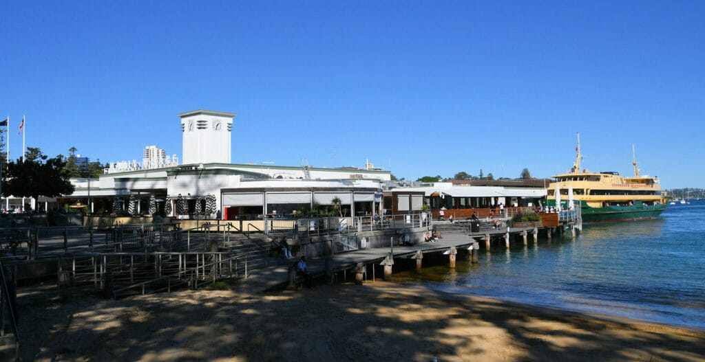
The hike starts at Manly Wharf and follows the coastline to the Spit Bridge. Along the way, you’ll pass through a variety of landscapes, including beaches, cliffs, and bushland. The trail offers stunning views of the Sydney Harbour and the Pacific Ocean, making it a great choice for a day hike.
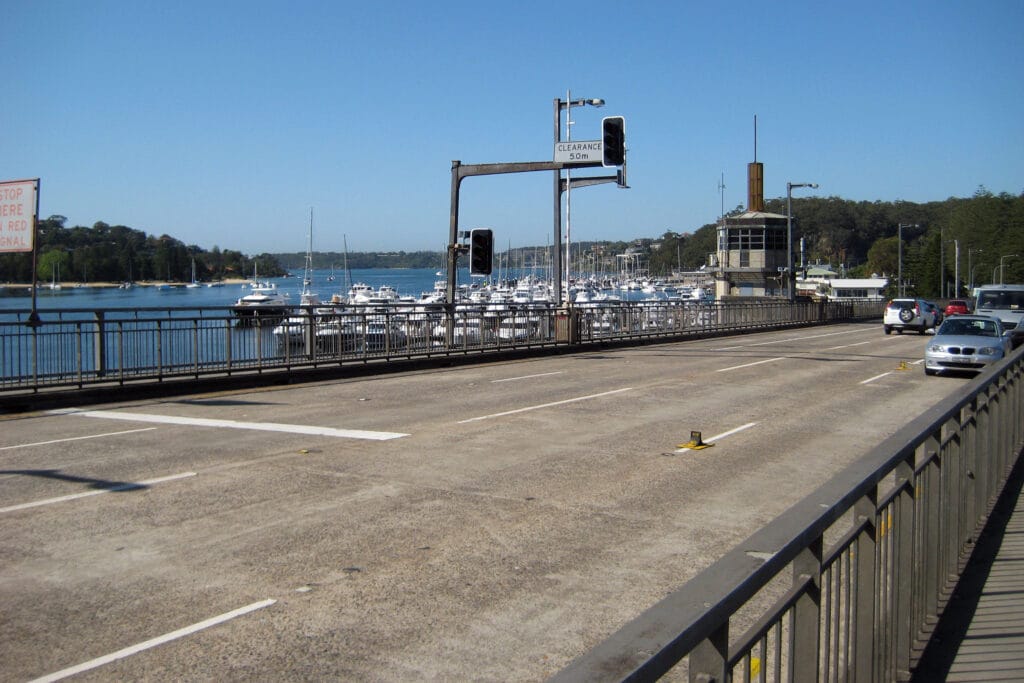
This hike is a great way to explore the northern beaches of Sydney and enjoy the stunning coastal scenery. The trail is well-marked and offers a variety of landscapes, making it a great choice for a day hike.
- Difficulty Rating: Moderate
- Start Location: Manly Wharf
- End Location: Spit Bridge
- Route Distance: 10 km
- Time to Complete: 3-4 hours
- Facilities: Toilets and picnic facilities at various points along the trail, parking available at Manly Wharf
- Distance and travel time from CBD: Approximately 15 km, 30 minutes by car to Manly Wharf
- Google Map Link: https://maps.app.goo.gl/2JRjqngks7z38Kas6
11. Hermitage Foreshore Walk
The Hermitage Foreshore Walk is a beautiful coastal walk that offers panoramic views of Sydney Harbour, including the Harbour Bridge and Opera House. This trail takes you through a variety of landscapes, including beaches, cliffs, and bushland.
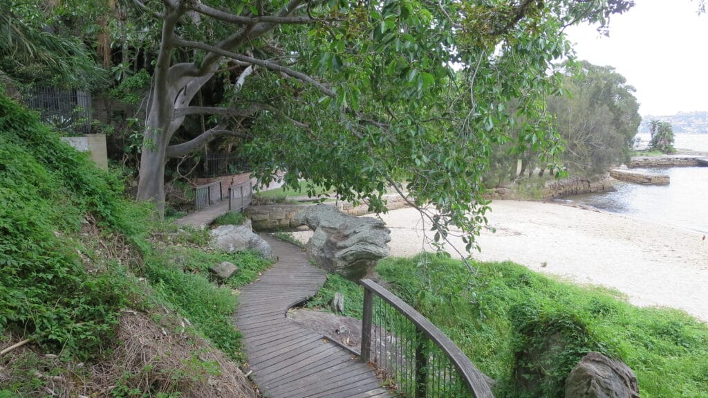
The hike starts at Nielsen Park and follows the coastline, looping back to the starting point. Along the way, you’ll pass through a variety of landscapes, including beaches, cliffs, and bushland. The trail offers stunning views of Sydney Harbour, making it a great choice for a day hike.
This hike is a great way to explore the eastern suburbs of Sydney and enjoy the stunning harbour views. The trail is well-marked and offers a variety of landscapes, making it a great choice for a day hike.
- Difficulty Rating: Easy
- Start Location: Nielsen Park
- End Location: Nielsen Park
- Route Distance: 1.8 km
- Time to Complete: 1-2 hours
- Facilities: Toilets and picnic facilities at the start/end point, parking available at Nielsen Park
- Distance and travel time from CBD: Approximately 8 km, 20 minutes by car
- Google Map Link: https://maps.app.goo.gl/mxpi8NisGuqUEg3A8
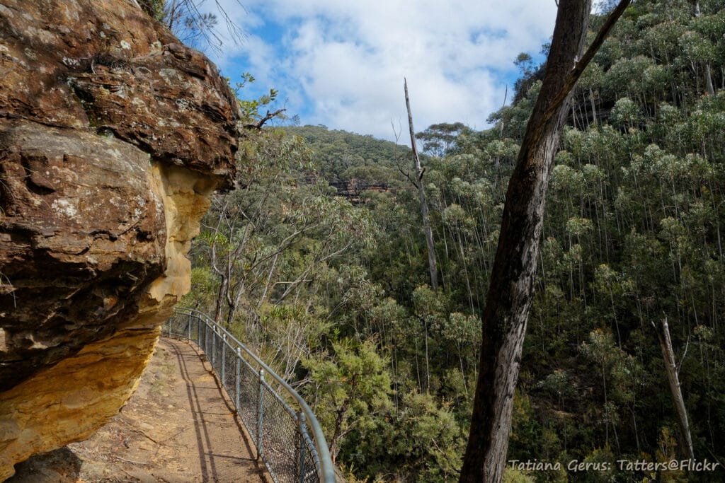
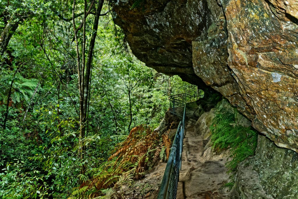
12. Wentworth Pass
The Wentworth Pass in the Blue Mountains is a challenging but rewarding hike. This trail takes you through a variety of landscapes, including eucalyptus forests, cliffs, and waterfalls.
The hike starts at the Wentworth Falls picnic area and follows a well-marked trail through the park. Along the way, you’ll pass through a variety of landscapes, including eucalyptus forests, cliffs, and waterfalls. The trail offers stunning views of the Blue Mountains, making it a great choice for a day hike.
This hike is a great way to explore the Blue Mountains and enjoy the stunning natural beauty of the area. The trail is challenging, with some steep sections and stairs, but the stunning views and unique landscapes make it well worth the effort.
- Difficulty Rating: Hard
- Start Location: Wentworth Falls picnic area
- End Location: Wentworth Falls picnic area
- Route Distance: 5 km
- Time to Complete: 3-4 hours
- Facilities: Toilets and picnic facilities at the start/end point, parking available at Wentworth Falls picnic area
- Distance and travel time from CBD: Approximately 100 km, 1.5 hours by car
- Google Map Link: https://maps.app.goo.gl/ipq1Qc89k6vv2tHo8
13. Cape Bailey Track
The Cape Bailey Track is a beautiful coastal walk that offers stunning views of the coastline and the Pacific Ocean. This trail takes you through a variety of landscapes, including beaches, cliffs, and heathland.
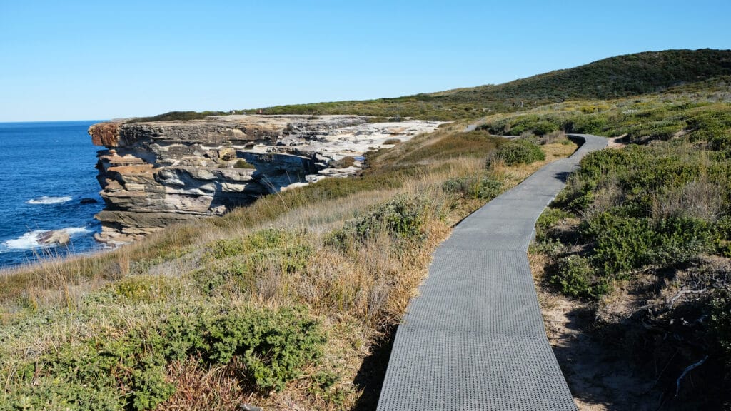
The hike starts at the Cape Solander car park and follows the coastline to the Cape Bailey Lighthouse. Along the way, you’ll pass through a variety of landscapes, including beaches, cliffs, and heathland. The trail offers stunning views of the coastline and the Pacific Ocean, making it a great choice for a day hike.
This hike is a great way to explore the Kamay Botany Bay National Park and enjoy the stunning coastal scenery. The trail is well-marked and offers a variety of landscapes, making it a great choice for a day hike.
- Difficulty Rating: Moderate
- Start Location: Cape Solander car park
- End Location: Cape Bailey Lighthouse
- Route Distance: 8 km
- Time to Complete: 3-4 hours
- Facilities: Toilets and picnic facilities at the start/end point, parking available at Cape Solander car park
- Distance and travel time from CBD: Approximately 35 km, 45 minutes by car
- Google Map Link: https://maps.app.goo.gl/394mDk1exUDVFes86
Frequently Asked Questions
What is the best time of year to go hiking in Sydney?
The best time to go hiking in Sydney is during the cooler months of the year, from April to October. During these months, the weather is typically mild and dry, making it ideal for outdoor activities like hiking. However, many of the hikes in Sydney can be enjoyed year-round, as long as you are prepared for the weather conditions.
Do I need any special equipment for these hikes?
Most of the hikes listed in this guide are suitable for beginners and do not require any special equipment. However, it’s always a good idea to wear comfortable, sturdy shoes and bring plenty of water, especially on longer hikes. Some of the more challenging hikes, like the Wentworth Pass and the Grand Canyon Track, may require a good level of fitness and some hiking experience.
Are these hikes accessible by public transport?
Many of the hikes listed in this guide, such as the Bondi to Manly Walk and the Hermitage Foreshore Walk, are easily accessible by public transport from Sydney’s CBD. However, some hikes, particularly those located in national parks or more remote areas, may require a car to reach the start of the trail.
Are these hikes suitable for children?
Many of the hikes listed in this guide are suitable for children, particularly the easier hikes like the Jibbon Loop Track and the Wollemi National Park (Glow Worm Tunnel). However, some of the more challenging hikes, like the Wentworth Pass and the Grand Canyon Track, may not be suitable for young children or those with limited hiking experience.
Can I bring my dog on these hikes?
While some parks and trails in Sydney do allow dogs, many of the hikes listed in this guide are located in national parks where dogs are not permitted in order to protect the local wildlife. Always check the specific rules and regulations for each hike before you go.